City of Rocks National Reserve - map, photos and other informations
Table of Contents
Description
City of Rocks National Reserve is a unique and visually stunning area located in southern Idaho, near the town of Almo. It covers an area of approximately 14,407 acres and was designated as a National Reserve in 1988 to protect its unique geological features and recreational opportunities.
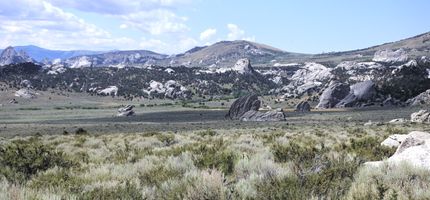
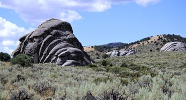
The reserve is characterized by its towering spires, massive boulders, and balancing rocks, which have been formed by volcanic activity and erosion over millions of years. These geological formations create a unique and dramatic landscape that is unlike anything else in the world. The reserve is also known for its rich history, as the City of Rocks was a popular stop along the California Trail during the mid-19th century, and numerous emigrant signatures and pioneer inscriptions can still be seen on the rocks today.
In addition to its geological and historical significance, City of Rocks National Reserve is also a popular destination for outdoor recreation, including rock climbing, hiking, camping, and wildlife viewing. There are several designated trails for hiking, including the Bath Rock Trail, which takes visitors to the top of one of the reserve's signature formations for panoramic views of the surrounding landscape. The reserve also features several campgrounds and picnic areas for visitors to enjoy, and there are several picnic sites with historical significance, including Register Rock, where pioneers signed their names to document their travels along the California Trail.
Overall, City of Rocks National Reserve is a truly unique and breathtaking place, offering visitors the opportunity to explore the incredible geological formations and rich history of the area. Whether you are a rock climber, hiker, or simply someone who appreciates natural beauty, City of Rocks is a must-visit destination.
Photos of City of Rocks National Reserve
Average weather in City of Rocks National Reserve
|
|
|
|
|
|
|---|---|---|---|---|
| Jan | -3 °C 27 °F | -10 °C 14 °F | 3 mm 0.1 in | 30 mm 1.2 in |
| Feb | -1 °C 30 °F | -9 °C 16 °F | 5 mm 0.2 in | 23 mm 0.9 in |
| Mar | 5 °C 41 °F | -4 °C 25 °F | 12 mm 0.5 in | 20 mm 0.8 in |
| Apr | 10 °C 50 °F | -1 °C 30 °F | 29 mm 1.1 in | 12 mm 0.5 in |
| May | 16 °C 61 °F | 4 °C 39 °F | 62 mm 2.4 in | 6 mm 0.2 in |
| Jun | 23 °C 73 °F | 10 °C 50 °F | 23 mm 0.9 in | 0 mm 0.0 in |
| Jul | 29 °C 84 °F | 16 °C 61 °F | 24 mm 0.9 in | 0 mm 0.0 in |
| Aug | 27 °C 81 °F | 15 °C 59 °F | 29 mm 1.1 in | 0 mm 0.0 in |
| Sep | 22 °C 72 °F | 10 °C 50 °F | 32 mm 1.3 in | 1 mm 0.0 in |
| Oct | 13 °C 55 °F | 3 °C 37 °F | 25 mm 1.0 in | 4 mm 0.2 in |
| Nov | 5 °C 41 °F | -4 °C 25 °F | 12 mm 0.5 in | 18 mm 0.7 in |
| Dec | -3 °C 27 °F | -10 °C 14 °F | 4 mm 0.2 in | 32 mm 1.3 in |
Other parks nearby
-
Castle Rocks State Park4.7 mi (7.5 km)|state park
-
Lake Walcott State Park43.5 mi (70.0 km)|state park
-
Minidoka National Historic Site50.1 mi (80.6 km)|national historic site
-
Massacre Rocks State Park60.3 mi (97.1 km)|state park
-
Golden Spike National Historical Park67.5 mi (108.7 km)|national historical park
User Reviews
Share your experience! Your honest feedback helps others make informed decisions.
Login to add new review


